
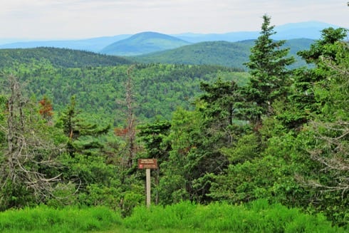
Mount Sunapee, identified as Sunapee Mountain on federal maps, is in western New Hampshire and rises to its highest point at 2,726 feet above sea level.
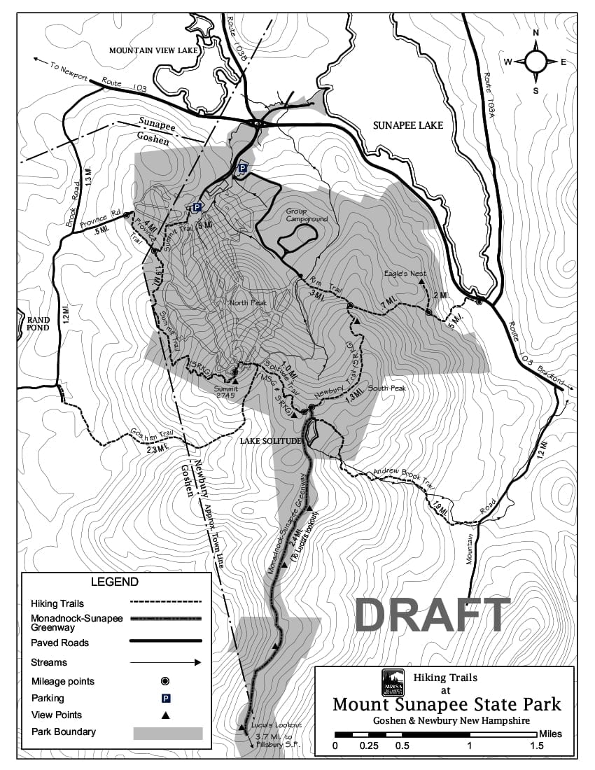
Along the five-mile ridge, there are three secondary peaks: White Ledges (2,716 feet), North Peak (2,290 feet), and South Peak (2,608 feet). At the northern end of the ridge is the summit (2,726 feet), located within Mount Sunapee State Park in Newbury, N.H. The state park extends west into Goshen, east to Newbury Harbor, and south along the Pillsbury-Sunapee Highlands. The Highlands connects to Pillsbury State Park in Washington and Goshen.
 Mount Sunapee is an iconic mountain beloved for its natural, cultural, recreational, and historical resources. On and around the mountain there are diverse ecosystems, vital water resources, and ecologically valuable forestland. The vast acreage of protected land provides habitat for wildlife, and open space for public outdoor enjoyment, discovery, and recreation.
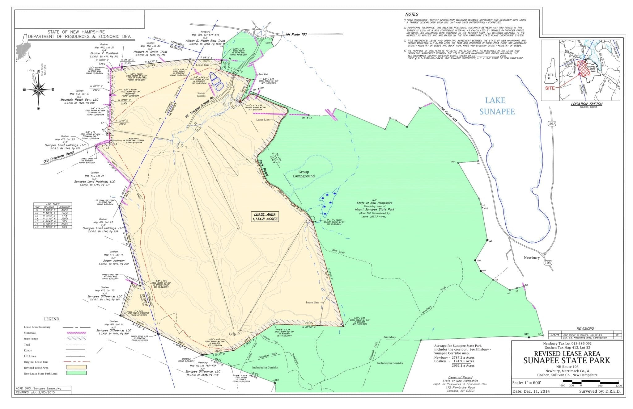
Mount Sunapee State Park (including the Pillsbury-Sunapee corridor) covers approximately 2,962 acres, which takes in:
- wild, forested highlands that includes an exemplary natural community system and rare ancient forest,
- a network of hiking trails,
- a secluded campground offering lean-to and platform sites on the mountain,
- the developed ski area, and
- lakeside beach and boat launch (with limitations) on Lake Sunapee.
Seasonal and year-round pursuits at the park range from alpine skiing, hiking and snowshoeing to camping, fishing, boating, swimming, picnicking, and other recreational outdoor activities.
According to State of New Hampshire mapping, the park includes 2787.2 ± acres in Newbury and 174.9 ± in Goshen.
In 1998, the State leased the ski area to a private operator (Okemo, Inc.). In September 2018, Vail Resorts acquired the Mount Sunapee lease and ski area/resort operations. The leasehold area now takes in approximately 1135 acres of parkland, according to the revised 2014 lease area map.
 On Mount Sunapee, the Monadnock-Sunapee Greenway—a hiking trail that links Grand Monadnock with Mount Sunapee—connects with the Sunapee-Ragged-Kearsarge Greenway. The SRK Greenway is a 75-mile loop of interconnected hiking trails, which circle the Lake Sunapee area and link Sunapee, Ragged and Kearsarge mountains.
Download/view: Mount Sunapee State Park – Trail Map (pdf 156kb)
Links to N.H. Division of Parks & Recreation: Mount Sunapee State Park and Mount Sunapee State Park Campground Information