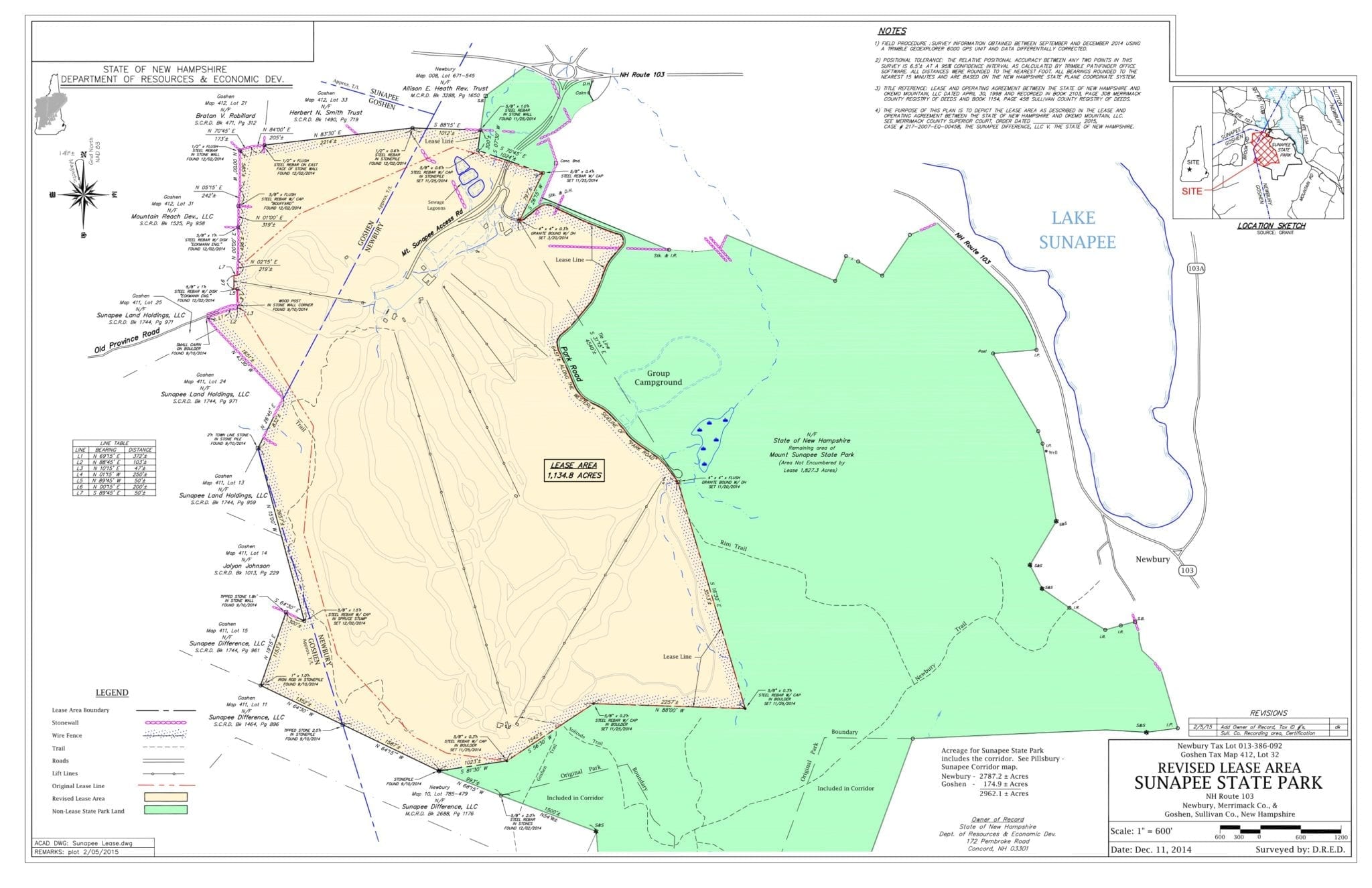
DRED (Dept. of Resources and Economic Development) has released a revised map of the lease area at Mount Sunapee State Park. The map is based on the Merrimack Superior Court decision of July 8, 2014. According to the State website, DRED has filed the revised map with the Superior Court.
See: Revised Map Lease Area Mount Sunapee 2015 (pdf 713Kb) – Original lease line is shown (red dotted line).
In a decision that still mystifies many, including the Friends of Mount Sunapee, the Court found that the western and northern leasehold boundaries of the ski area are the same as the State Park boundaries.
The Concord Monitor, in its editorial “State should say no thanks to Sunapee” (December 28,2 2014), wrote:
“Nearly a decade ago, this paper’s editors met with the leaseholder and his team, scrutinized documents and maps, and debated their meaning. We were unanimous in our decision that their interpretation of the maps and lease history was self-serving and wrong. The state’s intent was always to retain a buffer of public land between the ski area and the park’s boundaries, and no right to expand was ever granted. Unfortunately, in a decision that mystified us, Merrimack County Superior Court Judge Larry Smuckler disagreed.”
See: Merrimack Superior Court Order – 2014 July 10 – Sunapee Difference, LLC vs. The State of New Hampshire (pdf 127Kb)
See related information via… https://www.friendsofmountsunapee.org/okemo-legal-brief-reveals-real-estate-intentions/
See related Letter to the Editor published in InterTown Record (Feb. 10, 2015)
[fbshare url=”https://www.friendsofmountsunapee.org/?p=854″ type=”button” width=”100″] [twitter url=”https://www.friendsofmountsunapee.org/?p=854″ style=”horizontal” float=”left”]